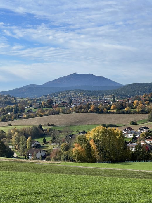
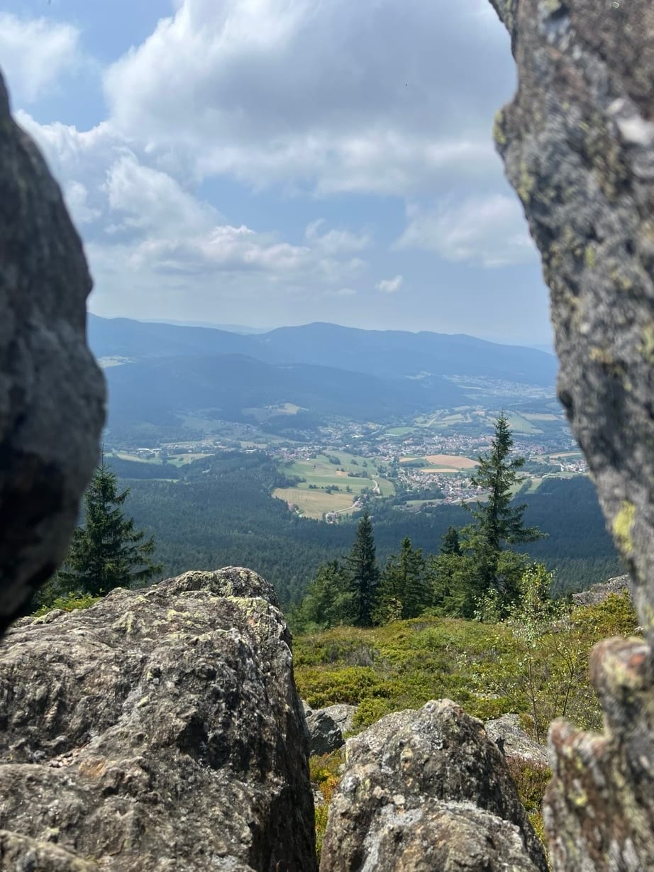
A valley basin ringed by the thousand-metre peaks of the Bavarian Forest: Osser, Arber, Kaitersberg, Hoher Bogen. Everything here we gathered ourselves – with distances from our own front door, not from some village sign.
For 3 walks the car stays put – they begin right outside the house.
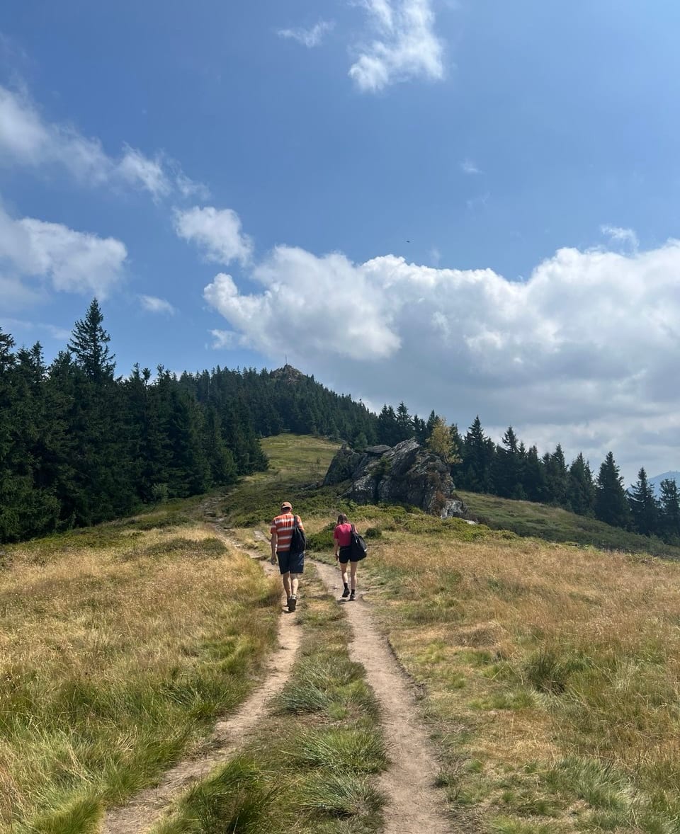
From the balcony it lies just outside the view to the left, yet it defines this area: a twin summit of granite blocks right on the Bohemian border. It is six kilometres to the Sattel car park, and from there the path crosses the Osserwiese, first to the Kleiner Osser and then up. If you prefer, walk the whole round from our front door – then the car stays put.
From the Sattel car park to the Osserwiese it took us an hour and a half, including a fifteen-minute break; brisk walkers manage it in one. From the meadow up to the summit is another half to three quarters of an hour. Starting instead from the Lohberg walkers' car park down in the valley means three to three and a half hours. Coming down is considerably quicker in every case.
Sturdy footwear is not advice but a requirement: the paths on the Osser are stony and steep in places, over boulders and roots that turn slippery when wet. For comparison – the Arber takes a good hour from the valley station on wide forest tracks. This is a different matter. Take plenty to drink, and something to eat on the way never hurts.
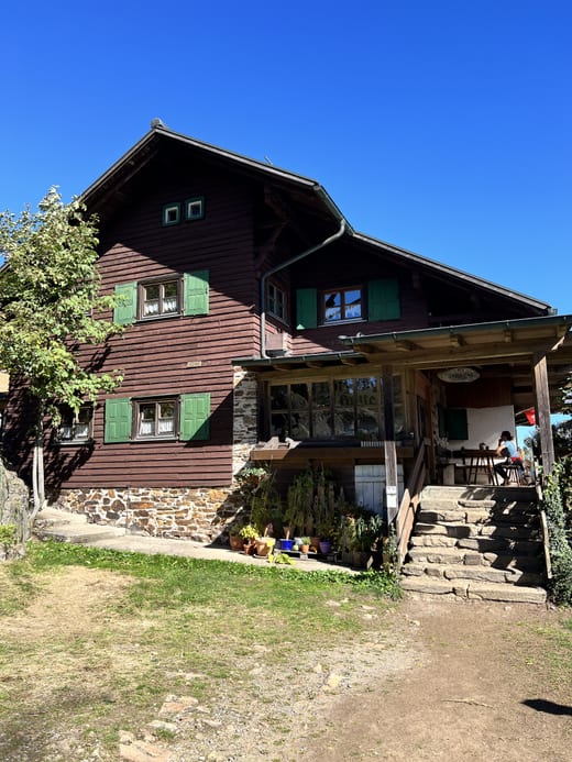
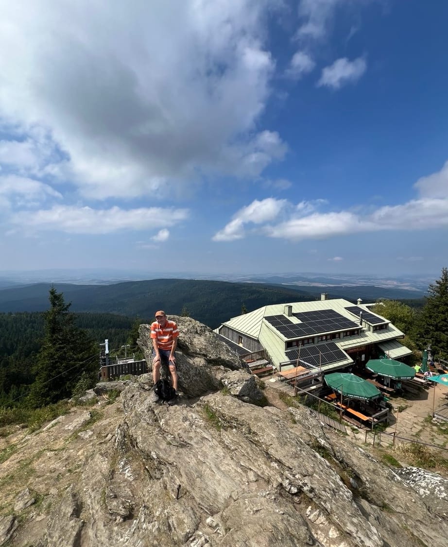
At the top are the Osserschutzhaus, the summit cross and the Künische Kapelle, built in 1986 as a sign across the border, and the view reaches far into Bohemia. The hut always has two soups on the stove, plus cold cuts and the local Osser beer, brewed with mountain spring water. Open May to November, 10am to 6pm; call ahead if the weather looks uncertain.
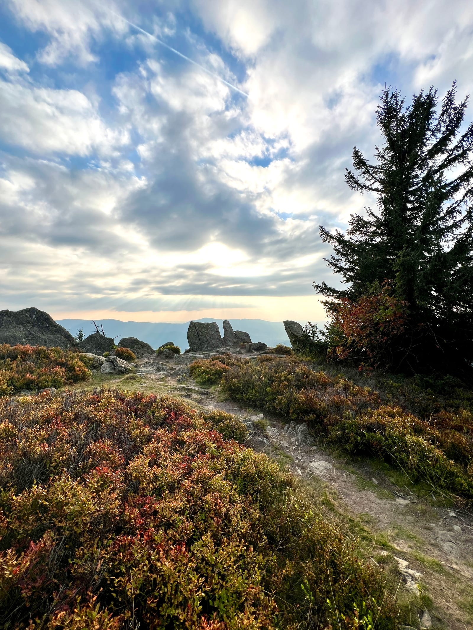
In high summer the Osserwiese is full of wild blueberries, with raspberries along the path – in October it glows red.
Part of the hut's beer garden already lies in Czechia – sit down there and you have crossed the border in more than a symbolic sense.
Opened in 2025 and extended again in August 2026: eleven runs across some 400 vertical metres, from a green family trail through flowlines to red jumplines. The park was built with beginners and children in mind – if you have never ridden a bike park, this is where you start.
Two drag lifts and the six-seater Sonnenhang chairlift carry the bikes up, with conveyor belts in the practice area. Special lift holders make the drag lifts manageable for children too.
Bikes and protective gear can be hired on site, and there is a workshop, a shop and skills courses with qualified coaches. You need bring nothing with you.
19 km from our front door – the same base station as the Arber cable car.
Season from mid-April, usually daily from around 10am to 5.30pm. A full-face helmet is compulsory throughout the park.
The apartments are in Lam, in the Lamer Winkel – a valley basin in the northern Bavarian Forest, ringed by the Grosser Osser, Kaitersberg, Riedelstein and the Grosser Arber. From the balcony the view runs across the valley to the mountain ridges, and the forest begins just a few steps behind the house.
Hiking
More than 100 kilometres of waymarked trails cross the Lamer Winkel, including stages of the Goldsteig long-distance path. The Grosser Osser, with its Kuenisch chapel and mountain hut, is the local landmark – from the top the view reaches far into Bohemia. The border ridge trail, the Kaitersberg and the Kleiner Arbersee, reached by the Arbersee railway from Lohberg, are all worth the trip.
Culture and glass art
The Bavarian Forest is glass country: at the Glasdorf in Arnbruck and at Joska in Bodenmais you can watch the glassblowers at work. The Fürstenzeche in Lam leads into the mountain as a visitor mine. And with the Czech border close by, Domažlice, Plzeň or a day trip to Prague are all within easy reach.
Active in summer
The region is well suited to cycling and mountain biking. If you are arriving with your own bike: a storage spot can be arranged, just let us know in advance. Nearby you will also find a golf course, boating, and – for the view from above – paragliding.
Winter
For downhill skiing it is 19 kilometres to the Großer Arber – with 13 kilometres of pistes from blue to black, six lifts and its own children's area, the largest family ski resort in the Bavarian Forest. The Hoher Bogen is closer and quieter. The real strength of the region, though, is cross-country skiing: 56 kilometres of tracks across two snow-reliable centres, plus the link to the 150-kilometre Bayerwaldloipe. For a gentler pace there are cleared winter walking paths, snowshoe tours and two toboggan runs – the one on the Hoher Bogen is floodlit and open in the evening. Afterwards, the neighbouring Waldlerhaus is a warm place to stop.
Tips for the area
A selection of what is within easy reach from here – from the local summit to the inn, the bakery and a day trip to Prague.
Distances are approximate driving distances from the house. For summits, ridges and mountain huts the straight-line distance is given, because you walk there – the road takes a long way round.
These are the destinations. The routes that lead there – with distance, walking time, difficulty and the drive to the trailhead – are further down under Hiking and cycling
▶Mountains and summits18
Panoramaweg Lam – circular path with views across the valley basin, starting right in the village1 km
Großer Osser – with the Osserschutzhaus mountain inn and the Osserwiese meadow4 km as the crow flies
Kleiner Osser – 1266 m, the lower of the two Osser summits – the first one you reach from the saddle. At the top, a plain summit cross on piled-up boulders4 km as the crow flies
Künischer Grenzweg – border ridge trail with the Naturkino viewpoint4 km as the crow flies
Zwercheck – neighbouring summit of the Osser, on the border ridge trail with the Naturkino viewpoint8 km as the crow flies
Kaitersberg – with the Rauchröhren rock formations9 km as the crow flies
Kötztinger Hütte – walk starting from Hutlach9 km as the crow flies
Kleiner Arber – 1384 m, reachable on foot only – and far quieter than its big brother11 km as the crow flies
Großer Arber – at 1456 m the highest mountain in the Bavarian Forest, with a summit chapel and views in every direction. By cable car or on foot12 km as the crow flies
Achttausender-Tour – from the Arber to the Eck12 km
Wanderparkplatz Eck – starting point for the border ridge and the Achttausender tour12 km
Skigebiet Hoher Bogen – the smaller and quieter of the two, with a chairlift and runs along the ridge. Closer than the Arber and good for half a day13 km
Sessellift Hoher Bogen – for when it should be easy for once: the chairlift carries you up to the ridge without effort, and at the top there are inns and the view across the Lamer Winkel valley into Bohemia. In summer there is also a summer toboggan run13 km
Arber-Gondelbahn – takes you almost to the summit of the Großer Arber in a few minutes – from the top station there are still 76 metres of ascent on foot19 km
Zwölftausender-Tour – from the Kaitersberg to the Großer Arber, twelve summits above a thousand metres – not a circular route; it ends at the Arbersee. Usually walked in two day stages19 km
Skigebiet Großer Arber – the largest family ski area in the Bavarian Forest: 13 km of pistes from blue to black, plus a 5 km ski route down to Bodenmais. A six-seat gondola, two six-seat chairlifts, three drag lifts and four magic carpets, as well as the ArBär children's area. Fully automatic snowmaking when the natural snow stays away19 km
Bikepark Arber – at the valley station of the Arber cable car: eleven descents over 400 metres of altitude, from green to red, the lifts carry bikes, with hire and skills courses on site. Full-face helmets are compulsory19 km
Berghotel Mooshütte – starting point for walks; 20 minutes on foot to the Kleiner Arbersee19 km
▶Lakes, moors and waterfalls14
Kneippbecken – a small facility just behind the house – for cooling your feet after a walk, freely accessible and open all year100 m
Osserbad Lam – a year-round pool with indoor and outdoor areas, two slides and a sauna complex. Free with your guest card – closed on Tuesdays, except during the Bavarian school holidays2 km
Seepark Arrach – swimming lake with a lawn, and the starting point for circular walks through the Arrach bog6 km
Arracher Moor – raised bog with around 500 m of boardwalk, easily reached from the Seepark7 km
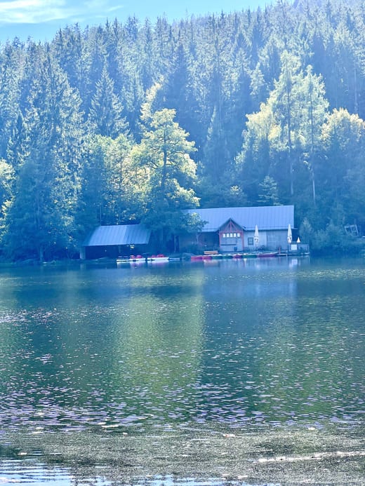
Kleiner Arbersee – the quieter of the two: no boat hire, but peace, the Seehäusl for a rest, and floating islands here too. The little Arberseebahn road train runs up from Lohberg; otherwise it is 20 minutes on foot from the Berghotel Mooshütte10 km as the crow flies
Seerosenbad – natural swimming pool in Neukirchen beim Heiligen Blut13 km
AQACUR Badewelt – in Bad Kötzting, with the largest sauna complex in the area: Finnish sauna, herbal, crystal and steam saunas, a sanarium with coloured light for beginners, plus a brine steam bath, a graduation tower, an ice fountain and an open fire. In the sauna garden there is a banya in a log cabin18 km
Großer Arbersee – an ice-age lake at the foot of the Arber, circled by a flat path of a good two kilometres. Rowing boats at the shore, an inn beside it, and in the water the floating peat islands – slabs of peat that have come loose from the bottom and drift across the lake23 km
Blaibacher See – a reservoir on the Schwarzer Regen with a lawn and hire of boats and stand-up paddleboards. From here the Bl05 circular path follows the shore to the Höllensteinsee and back – 15.5 km, four and a half hours, with hardly any climb in one go23 km
Drachensee – near Furth im Wald23 km
Steinbruchsee – near Furth im Wald24 km
Rißlochfälle – the highest waterfalls in the Bavarian Forest, near Bodenmais: 55 m of drop in five stages, a nature reserve since 1939. Easily combined with the Hochfall30 km
Hochfall – waterfall near Bodenmais, easily combined with the Rißloch falls in one day30 km
Höllensteinsee – a second reservoir on the Regen, with an inn at the lookout rock. Linked to the Blaibacher See by the Bl05 circular path – the round can be started from either lake34 km
▶Mountain huts and stops along the way12
Café zum Sahneberg – close enough for an afternoon; both a destination and a place to stop for coffee3 km
Osserschutzhaus – on the Großer Osser, 1293 m, a hut of the Bavarian Forest Club. Two soups are always on the stove, plus small dishes. May to November, 10am to 6pm – call ahead if the weather looks uncertain4 km as the crow flies
Drexler Arrach – Bärwurz herbal schnapps distillery with a museum café7 km
Chamer Hütte – below the summit of the Kleiner Arber, 1289 m, run by the Bodenmais ski club. Mid-June to the end of October, and mid-December to the end of March11 km as the crow flies
Schwellhäusl – a former log-driving sluice house in the national park below the Großer Falkenstein, run by the same family since 1870. The beer there comes out of the rock – tapped straight from the stone. On foot from the Zwieslerwaldhaus walkers' car park; see the list of walks16 km as the crow flies
Berghaus Sonnenfels – on the Großer Arber at 1150 m near Bayerisch Eisenstein, with a large sun terrace looking across to the Großer Falkenstein, hearty Bavarian cooking and a vegan vegetable schnitzel, plus a playground. Open all year19 km
Eisensteiner Hütte – on the Großer Arber near the cable car, with panoramic views. Daily 10am to 3.30pm, closed while the cable car is serviced in April/May and in November19 km
Berggasthof Hohenbogen – up on the Hoher Bogen, the starting point for circular walks to the Bärenriegel and the Eckstein22 km
Schönblick – on the Hoher Bogen at almost 1000 m, with views into Bohemia, Bavarian-Bohemian cooking, roasts and pork knuckle from the wood-fired oven, hot food served continuously from 11am to 7.30pm22 km
Forstdiensthütte Hohenbogen – a place to stop on the summit path across the Hoher Bogen22 km
Café Waffel – in the old station building in Miltach, with the waffle factory's own shop28 km
Gutsalm Harlachberg – an alpine inn with a beer garden, named the finest beer garden in the Regen district in 201731 km
▶Leisure and attractions24
Golfplatz Lam – a 9-hole panoramic course at the Sonnenhof with views into the mountains, open to beginners and day visitors too – book at reception100 m
Tennis und Squash am Sonnenhof – indoor and outdoor courts, bookable without staying there – book at reception100 m
Panorama Park Lam – a park between the market square and the Osserbad pool, with a barefoot path, a fitness trail, a herb spiral, a playground and hammocks1 km
Kutschenfahrten Brandl – from Lam; booking required1 km
Waldbahn nach Cham – the train ride through the valley is an outing in itself: from Lam via Bad Kötzting along the Weißer Regen to Cham, through meadows and woods and past small country stations. Free with the guest card – an afternoon without the car, there and back1 km
Reiterhof Woferlbauer – riding lessons and a trail-riding station, in Lohberg2 km
Café zum Sahneberg – a destination and a place to stop, only 3 km away – also listed under the mountain inns3 km
Tierpark Lohberg – more than 400 animals of around 100 species: wolves, lynx, elk, wildcats and otters, plus the House of the Wolf, a petting zoo and a playground. April to October 9am to 5pm, otherwise 10am to 4pm6 km
Minigolf – in Arrach and Bad Kötzting7 km
Reiterhof Mühlbauer – riding school and pony rides, in Kummersdorf near Arrach10 km
Winterrodelbahn Hoher Bogen – over 700 m long and the longest floodlit run in the Bavarian Forest – tobogganing here works after dark too13 km
Rodelbahn Lohberg-Scheiben – a 500 m natural toboggan run at 1050 m, right by the cross-country skiing centre. No lift and no sledge hire – bring your own sledge and pull it up yourself. Reachable by the Lam–Lohberg–Arber ski bus14 km
Arber-Gondelbahn – takes you almost to the summit of the Großer Arber in a few minutes – from the top station there are still 76 metres of ascent on foot19 km
Kurpark Bad Kötzting – with minigolf19 km
Bad Kötzting – a Kneipp spa town19 km
Freizeitzentrum Hoher Bogen – with the former NATO towers22 km
Drachenhöhle – near Furth im Wald24 km
Drachenstich – a pageant play in Furth im Wald24 km
Café Lieblingsplatz – billiards, table football and darts, in Blaibach25 km
Abenteuer-Wildgarten – in Furth im Wald: a suspension bridge, bog walkways, a maze and an underwater station looking into the fish pond. All year round, from sunrise to sunset26 km
Bob-Coaster Silberberg – in Bodenmais33 km
Waldwipfelweg – near Sankt Englmar: 370 m of walkway at up to 30 m above the ground, plus a 52 m lookout tower with tube slides46 km
Schlosspark Falkenstein – one of the largest rock parks in Bavaria: the Himmelsleiter ("ladder to heaven") climbs a long wooden staircase between the granite boulders, and there are the Teufelssteg, the Froschmaul, the Herzbeutelgässchen and, in the Hohler Stein, a natural cave. Four waymarked paths lead through it; a good hour's drive57 km
Baumwipfelpfad – in Neuschönau: 1.3 km through the treetops at 8 to 25 m above the ground, with a 44 m tree tower68 km
▶Glass, crafts and mining9
Fürstenzeche Lam – a show mine3 km
Glaskunstladen Lohberg – small pieces of regional glass art, on the way to the wildlife park7 km
Museen im Drexler-Hof – distillery, crafts, minerals and woodwork, in Arrach7 km
Glasdorf Arnbruck – the Weinfurtner glass village, with glassblowing demonstrations, gardens and a factory shop17 km
Joska Bodenmais – a glass paradise with a demonstration workshop, a glass garden and a play area – home to the largest mouth-blown Christmas bauble in the world28 km
Gläserne Scheune – a painted farmhouse near Viechtach30 km
Silberbergwerk Bodenmais – a show mine33 km
Theresienthal – a glassworks with a museum, near Zwiesel35 km
Glasmuseum Frauenau – the state museum of glass culture, from its beginnings in Mesopotamia to the present day43 km
▶Shopping and bakeries12
REWE – in Lam1 km
Café Konditorei Weißgawa – cakes and chocolates, in Lam1 km
Geschenkehaus Drexler – gifts and local specialities, on the market square in Lam1 km
Edeka – in Arrach5 km
REWE – in Arrach6 km
Bäckerei Schifferl – inside the REWE supermarket in Arrach6 km
Bio-Holzofenbäckerei Drexler-Brey – wood-fired oven bread, in Arrach6 km
Konditorei-Bäckerei Brey – with a small café, in Hohenwarth10 km
Netto – in Neukirchen beim Heiligen Blut11 km
EDEKA Gatzke – in Hohenwarth11 km
Bad Kötzting – Aldi, EDEKA, Norma, REWE and an organic shop19 km
Café Waffel – the waffle factory's own shop, in Miltach28 km
▶Cities and Czechia14
Bad Kötzting – a spa town with a market square and spa gardens – the nearest little town for a stroll19 km
Bayerisch Eisenstein – a border village with a historic railway station – the border runs straight through the building24 km
Bodenmais – a spa resort with a pedestrian zone, glassworks to visit and a cable car up the Silberberg28 km
Železná Ruda – Czech Republic, a border town near Bayerisch Eisenstein28 km
Cham – the district town, with a railway station36 km
Klatovy – Czech Republic38 km
Domažlice – Czech Republic40 km
Straubing – a town on the Danube in the Gäuboden plain, with a historic main square and city tower68 km
Pilsen – Czech Republic81 km
Deggendorf – on the Danube81 km
Regensburg – the old town and the Stone Bridge are UNESCO World Heritage103 km
Passau – the city of three rivers, where the Danube, Inn and Ilz meet108 km
Český Krumlov – Czech Republic145 km
Prag – Czech Republic168 km
Eating and drinking in the villages
The menus here offer things you will not find elsewhere: trout from the local streams and ponds, often from the kitchen's own stock, and game from the surrounding forests. For dessert there is Kaiserschmarrn, torn fresh in the pan. And with it an Osser beer – brewed seven kilometres away in Lohberg, for more than 160 years and with mountain spring water from the Großer Osser.
Inns, cafés and pizzerias, sorted by village. The distance refers to the village – within it the places are a few minutes' walk apart. You will find vegetarian dishes almost everywhere: cheese spaetzle, dumplings, salads and soups are part of Bavarian cooking. In Lam alone, five places state it explicitly on the menu – so you do not even need the car. Fully vegan is thinner on the ground, and to be honest, all four places that state it explicitly are a drive away: Café Lieblingsplatz in Blaibach, the Wasserwirtschaft and the L. A. in Cham, and the Berghaus Sonnenfels on the Arber. Elsewhere a quick phone call in advance pays off – most hosts are happy to cater for it once they know in good time.
▶Lam1 km
Waldlerhaus – right next door: wood-fired pizza and local Waldler specialities, vegetarian dishes too, evenings from 6pm, closed Mondays and Tuesdays, cash only
Zum Kirchenwirt – on the market square: Bierschnitzel and roast pork from the wood-fired oven, with lighter and vegetarian dishes as well
Dimpfl-Stadl – on the market square, with live music – hearty Bavarian cooking, and generous, good meat dishes
Hotel zur Post – in the village, with dining rooms and a sun terrace; in the evening a set menu with choices and a salad buffet
Landgasthof Postwirt – in the hamlet of Frahels: game, and trout from their own ponds, with a playground and animal enclosure
Rösslwirt – their own butcher's shop, regional cooking with produce straight from local farms
Gasthof-Metzgerei Stöberl – a family business for over 300 years: Bavarian cooking with meat from their own butcher's shop, vegetarian dishes too
Hotel Sonnbichl – above the village with panoramic views, evenings 5.30pm to 8.30pm, vegetarian dishes too
Grill & Chill Pub – Balkan cooking
Zum Italiener – pizza and pasta
Café Konditorei Weißgawa – cakes and chocolates
Petrusstube im Hotel Sonnenhof – right in the neighbourhood, with special Sunday offers expressly open to visitors from outside as well
Bar im Hotel Sonnenhof – just across the road and likewise open to outside guests – an evening without driving
Hotel Das Bayerwald – on the edge of the village at Arberstraße 73: regional and international cooking, with a terrace and garden. They will cook vegan on request – freshly, carefully and without any fuss, even if you turn up unannounced. When we praised the sauce, the owner came out of the kitchen with what was left and sent it along with us. All the same, it does no harm to call ahead: 09943 9530
▶Remote farmsteads near Lam4 km
rustic farms outside the village, some of them reachable on foot
Einödhof Waldeck – a small parlour serving cold platters, a popular stop when walking
Zum Veitbauernhof – Hinteröd 1: game specialities from their own hunting, cold platters on a wooden board, freshly baked cakes and a panoramic garden – the farm stands on its own, so it is worth calling: 09943 3260
Zum Ödbauern – a forest farm at 786 m, with home-made cakes, cold platters and ice cream
▶Arrach7 km
Seepark D’Hoamat – a family business at the Seepark with a lakeside terrace; a small, well-chosen menu of cold dishes such as potato pancakes and mountain-farm bacon, plus coffee and home-made cakes
Gasthof Meindl – with their own butcher's shop
Brezn Pizza – home-made chips
Restaurant Charivari – in the Hotel Herzog Heinrich, Eckstraße 5: a four-course menu with a choice of three main dishes, one of them vegetarian, plus a salad buffet – if you are not staying at the hotel, please call ahead: 09943 9540
▶Lohberg7 km
Gasthof Zum Wastl – their own butcher's shop and a village store, with a beer garden
Restaurant Lux & Fux – by the wildlife park: Bavarian and Bohemian cooking, with a large sun terrace
▶Neukirchen beim Heiligen Blut13 km
Sport- und Wellnesshotel Waldschlößl – in the hamlet of Höllhöhe: a sports and spa hotel with 154 years of innkeeping tradition, Bavarian through to international
Wirtshaus Schindldacherl – the best-rated place in the village: Bavarian cooking in a cosy parlour with a mountain view
Gasthof Zum Wirt – above the village: traditional home cooking with regional produce, and a beer garden
Kolmsteiner Hof – a guesthouse with a café, home-made cakes and chocolates, Wednesday to Sunday 11am to 6pm
Hotel-Gasthof zum Bach – on Marktstraße, with a roof terrace
Sportgaststätte und Pizzeria Zum Lederer – in the hamlet of Walching: pizza from the wood-fired oven, plus a skittle alley and squash, evenings from 6pm
Gasthof zur Linde – on the market square, with a beer garden and panoramic views
XXL Café – home-made gateaux and cakes in XXL slices, plus schnitzel, burgers and salads, Wednesday to Saturday 2pm to 6pm
Genusshotel Hohenbogen – modern Bavarian cooking from regional ingredients, with a chef who has worked in starred restaurants
Klosterschänke Restaurant & Weinbar – a restored and listed inn dating from 1819: modern cooking with tapas, steaks and fish, plus a wine bar
▶Drachselsried14 km
Fräulein ANNA – the restaurant of the Rock & Chill Hotel Falter, Zellertalstraße 6 – burgers, Bavarian and international dishes, plus vegan and low-carb options, open every day, kitchen continuously from noon to 9pm. Bands and musicians play there regularly; dates are posted on the hotel's social media, and it is worth calling: 09945 94020
▶Nýrsko (Czech Republic)16 km
Penzion a restaurace Berry – in Zelená Lhota near Nýrsko: a family business serving Bohemian home cooking, with a terrace, daily 11am to 9pm (Sundays until 8pm) – in summer there are music evenings
▶Bad Kötzting19 km
Wirtshaus Osl – on the market square, Angus beef from their own mountain farm
Lindner Bräu Brauereigaststätte – with a beer garden and award-winning beer
Restaurant Goggolori – on Spitalplatz: Bavarian and international dishes, with coffee and cake every day
Backparadies – a glass-fronted bakery on Herrenstraße with home-made gateaux, cakes and chocolates, Monday to Saturday 9am to 4pm, Sundays from 11am
Höllensteinhaus – at the Höllensteinsee
Akropolis – Greek
▶Blaibach25 km
Café Lieblingsplatz – vegetarian and vegan, with billiards, table football, darts and a shop
Fischerstüberl – on the Regen by the Blaibacher See, with fish from their own waters
Enoteca Lucca – Italian
Vesuvio – Italian
▶Cham36 km
Wasserwirtschaft – right on the Regen by the blue bridge: Bavarian and regional cooking with home-made pasta, vegetarian and vegan dishes too, a beer garden, daily from 11am
Gasthaus am Ödenturm – a Bib Gourmand in the Michelin Guide: regional game and fish, home-made noodles, closed Sundays and Mondays
Sale & Zucchero – pizzeria
Pizzeria Caorle – pizzeria
Trattoria Al Gallo Nero – pizzeria
Restaurant Athen – Greek
L. A. Live Style Café – American cooking with vegetarian and vegan dishes, regular live music, step-free access
Spa and sauna at three distances
The apartment has no spa of its own – but three are within easy reach, one of them just across the road.
70 metres
Sonnenhof spa hotel
Pool and sauna area with an infinity pool facing the mountains. Day passes are available without an overnight stay. Tennis and golf are booked separately through reception.
2 kilometres
Osserbad in Lam
Indoor and outdoor pools, two slides and a sauna area. Free and unlimited with your guest card, for your whole stay. Closed Tuesdays, except during Bavarian school holidays.
18 kilometres
AQACUR Bad Kötzting
The largest sauna complex in the area: eight sweat rooms including a banya in a log cabin and a crystal sauna, plus a graduation tower, ice fountain and open fire.
The Sonnenhof and the AQACUR belong to other businesses – prices, times and booking directly there. For the Sonnenhof and the Osserbad feel free to ask us as well: we are on site and know what currently applies.
Hiking maps and current route suggestions are available at the tourist office on the market square in Lam.
Hiking and cycling
This region is a paradise for walkers: more than 300 kilometres of marked trails lie between the Osser, Arber and Kaitersberg – from a half-hour stroll to a ridge walk across eight summits. The codes in the table match the signposts; knowing them, you'll find your way without a map.
The forest begins eighty metres behind the house. For 3 of these walks the car stays put: they start right at the front door – from the half-hour climb to the mountain chapel to the three-hour round across the Osserwiese.
Walking times are guide values – allow a quarter of an hour more or less depending on fitness and breaks.
Hiking routes
Route
Length
Duration
Ascent
Drive
Difficulty
SAGENhafter RundwegThe one for families: hardly any climbing, but boards along the way telling the legends and stories of the valley. Manageable even with tired children.Start: the Lambach valley
5 km
1,5 h
170 m
–
easy
Rund um LamLa04The shortest of the numbered circuits and the easiest. Good for your arrival day, or when the weather is uncertain.Start: Lam
7.5 km
2 h
213 m
1.5 km 3 min
easy
PanoramawegLa02The name is to be taken literally: the path runs along the slopes above the village, and the view reaches across the valley basin to the Großer Arber.Start: the tourist office in Lam
8 km
2,5 h
330 m
1.5 km 3 min
moderate
Zum Bergkircherl Maria HilfThe shortest walk of them all: up the old Way of the Cross to the forest chapel above the Himmelreich. Legend has it that a woodsman vowed to build the chapel here after he had mocked a holy picture and then found himself in trouble.Start: right at the apartment
1.5 km
0,5 h
–
from the door
easy
Spaziergang zum Café am SahnebergThe short walk for an afternoon: just under three quarters of an hour uphill, with coffee and cake and a view at the top. The way back is downhill and much quicker.Start: right at the apartment
3 km
0,75 h
–
from the door
easy
Rundtour ab Himmelreich über die OsserwieseThe only walk here that needs no car at all: it starts at the front door and crosses the Osserwiese. In high summer wild bilberries and raspberries grow along the path there. The circuit ends at the meadow; if you still have breath, another half to three quarters of an hour puts you on the summit – and the way back is much quicker. The paths on the Osser are stony and steep in places, and the roots are slippery when wet – sturdy footwear is part of it.Start: right at the apartment
9.8 km
3 h
–
from the door
moderate
Runde zur Künischen Kapelle am OsserTo the little chapel on the flank of the Osser – shorter than the Riesen-Steig and still with a taste of the summit. The paths on the Osser are stony and steep in places, and the roots are slippery when wet – sturdy footwear is part of it.Start: Lambach
9.5 km
3 h
–
5.5 km 13 min
moderate
Vom Sattel über die Osserwiese auf den GipfelThe shortest way up the local landmark – good for a morning. From the saddle past the Osserwiese with its striking rocks, first onto the Kleiner and then the Großer Osser; in autumn the meadow glows. At the top are the mountain hut, the Künische Kapelle and the view far into Bohemia. Brisk walkers manage it in a good hour; with breaks it becomes two. Sturdy footwear is essential: the paths on the Osser are stony and steep, and the roots are slippery when wet.Start: the saddle car park above Lam
6 km
1,5–2,25 h
400 m
6 km 14 min
moderate
Auf den Osser zum SchutzhausThe big walk up the local landmark, a full day. From Oberlohberg it is about three and a half hours up to the mountain hut and two back down – from the Himmelreich a little longer still. It is hard work, and not because of the distance: the paths on the Osser are stony and often steep, over boulder fields and roots that are slippery when wet. For comparison: the Arber can be done from the valley station to the hut in a good hour on wide forest tracks – this is something else. Bring proper mountain boots, time and fitness.Start: Oberlohberg, or right at the apartment
14 km
5,5–6 h
–
8 km 15 min
demanding
Naturkino am ZwercheckInsider tipA cinema without a screen: twenty deckchairs on the hillside, with the whole mountain range in front of them. Admission free, showing in any weather.Start: the Scheiben car park in Lohberg
8 km
3 h
–
–
moderate
Schwarzecker RundwegInsider tipSteeply up to the ridge, then narrow paths to the silver summit cross. From there you look out over the whole Lamer Winkel – and meet hardly anyone on the way.Start: the Lohberghütte
8 km
3 h
–
–
demanding
Gibacht-RundwanderwegInsider tipPast the Pfennigfelsen, the Drei-Wappen-Felsen and the Kreuzfelsen to the glass summit cross on the Reiseck. From there you can see the Osser, the Arber, the Hohenbogen and the Kaitersberg all at once – and at the end an inn waits back at the starting point.Start: the Berggasthaus Gibacht near Eschlkam
5 km
2 h
–
18 km 23 min
moderate
Felsenpark Falkenstein mit der HimmelsleiterOne of the largest rock parks in Bavaria. The Himmelsleiter ("ladder to heaven") climbs a long wooden staircase between the granite blocks, and there are the Teufelssteg, the Froschmaul and, in the Hohler Stein, a real cave. Four paths lead through it.Start: the Falkenstein walkers' car park
4 km
2 h
–
57 km 61 min
moderate
Rundweg um den DrachenseeA flat circuit around the water, easily done with a pushchair. Afterwards the Further Drache waits in town – at sixteen metres long, the largest walking robot in the world.Start: Furth im Wald
5 km
1,5 h
–
26 km 30 min
easy
Zum SchwellhäuslLittle climbing, but a special destination: the former log-driving sluice house in the middle of the national park has been run by the same family since 1870, and the beer there comes out of the rock – tapped straight from the stone.Start: the Zwieslerwaldhaus walkers' car park
7 km
2–2,5 h
120 m
33 km 34 min
easy
Zum Hohen Riegel und zum TanneneckLa05Start: Lam
10 km
3–3,5 h
–
1.5 km 3 min
moderate
Durchs LiebestalRW 5Insider tipA circular walk on natural paths, much of it along the Aitnach stream – in autumn the valley glows. On the way are the Antonius chapel and the Kleiner Pfahl, the white quartz reef that runs right across the Bavarian Forest. Graded "very easy" and suitable for families. It lies near Viechtach, which makes it a half-day trip rather than a walk from the doorstep.Start: walkers' car park P1, Bierfeldstraße in Viechtach
10 km
2,5 h
250 m
30 km 35 min
easy
Zu den EinödhöfenLa07Past the old mountain farms of Trailling, Vorderöd and Hinteröd to Hinterwaldeck. Trailling has a chapel of its own, and several farms along the way serve cold platters and regional specialities – a walk on which nobody goes hungry.Start: the Einödhof Waldeck in Hinterwaldeck
10.1 km
3,25 h
421 m
5.4 km 12 min
moderate
Künischer GrenzwegLa01Along the old border between Bavaria and Bohemia, past the Naturkino viewpoint. The guidebooks expressly recommend it for experienced walkers.Start: Lam
12 km
4,5 h
751 m
1.5 km 3 min
demanding
Osser-Riesen-SteigLa03The classic climb up the Großer Osser, the landmark mountain of the Lamer Winkel. At the top, the summit cross, the mountain hut and the view far into Bohemia. The paths on the Osser are stony and steep in places, and the roots are slippery when wet – sturdy footwear is part of it.Start: the Lambach car park
13 km
4–5 h
–
5.5 km 13 min
demanding
Kaitersberg-PanoramawegAr06Along the ridge with its rock formations. The name keeps its promise – for long stretches the view opens out on both sides.Start: the tourist office in Arrach
14.9 km
6,5 h
867 m
6.7 km 11 min
demanding
Achttausender-TourEight summits above a thousand metres in one day – in the Bavarian Forest these are the "eight-thousanders". The most demanding walk in the area, and one for strong calves.Start: the Eck walkers' car park
15 km
5–6 h
900 m
12 km 15 min
demanding
Zwölftausender-TourTwelve summits above a thousand metres, from the Kaitersberg over the Mühlriegel, the Ödriegel and the Schwarzeck to the Großer Arber – the big sister of the Achttausender tour. Not a circular route: it ends at the Großer Arbersee, leaving your car some 30 kilometres away. Most people split it into two day stages, changing over at the Eck; the first stage is about 15 kilometres and 5 hours. On the Kaitersberg it goes over rock and boulder fields. You can get back by bus and train, free with the guest card.Start: Bad Kötzting
30.2 km
12 h
1,672 m
19.1 km 24 min
demanding
Rund um Blaibacher See und HöllensteinseeBl05Two reservoirs on the Schwarzer Regen in one day, linked by shore paths, patches of woodland and a lookout rock. Hardly any climb in one go – the 376 metres of ascent are spread over the whole circuit. There are inns at both lakes, though at the Blaibacher See only from April to October. The official starting point is Blaibach; from the Höllensteinsee the same round simply runs the other way.Start: Kirchplatz in Blaibach, or the Höllensteinsee walkers' car park
15.5 km
4,5 h
376 m
25 km 28 min
moderate
Durch den Kloster-Rotter-WaldLa06The longest of the circuits around the village. A full day, so pack provisions accordingly.Start: Lam
17.7 km
6 h
870 m
1.5 km 3 min
demanding
SAGENhafter Rundweg
easy
5 km · 1,5 h · 170 hm
The one for families: hardly any climbing, but boards along the way telling the legends and stories of the valley. Manageable even with tired children.
Start: the Lambach valley
Rund um Lam La04
easy
7.5 km · 2 h · 213 hm
The shortest of the numbered circuits and the easiest. Good for your arrival day, or when the weather is uncertain.
Start: Lam · 1.5 km drive, 3 min
Panoramaweg La02
moderate
8 km · 2,5 h · 330 hm
The name is to be taken literally: the path runs along the slopes above the village, and the view reaches across the valley basin to the Großer Arber.
Start: the tourist office in Lam · 1.5 km drive, 3 min
Zum Bergkircherl Maria Hilf
easy
1.5 km · 0,5 h · ascent not documented
The shortest walk of them all: up the old Way of the Cross to the forest chapel above the Himmelreich. Legend has it that a woodsman vowed to build the chapel here after he had mocked a holy picture and then found himself in trouble.
Start: right at the apartment
from the door
Spaziergang zum Café am Sahneberg
easy
3 km · 0,75 h · ascent not documented
The short walk for an afternoon: just under three quarters of an hour uphill, with coffee and cake and a view at the top. The way back is downhill and much quicker.
Start: right at the apartment
from the door
Rundtour ab Himmelreich über die Osserwiese
moderate
9.8 km · 3 h · ascent not documented
The only walk here that needs no car at all: it starts at the front door and crosses the Osserwiese. In high summer wild bilberries and raspberries grow along the path there. The circuit ends at the meadow; if you still have breath, another half to three quarters of an hour puts you on the summit – and the way back is much quicker. The paths on the Osser are stony and steep in places, and the roots are slippery when wet – sturdy footwear is part of it.
Start: right at the apartment
from the door
Runde zur Künischen Kapelle am Osser
moderate
9.5 km · 3 h · ascent not documented
To the little chapel on the flank of the Osser – shorter than the Riesen-Steig and still with a taste of the summit. The paths on the Osser are stony and steep in places, and the roots are slippery when wet – sturdy footwear is part of it.
Start: Lambach · 5.5 km drive, 13 min
Vom Sattel über die Osserwiese auf den Gipfel
moderate
6 km · 1,5–2,25 h · 400 hm
The shortest way up the local landmark – good for a morning. From the saddle past the Osserwiese with its striking rocks, first onto the Kleiner and then the Großer Osser; in autumn the meadow glows. At the top are the mountain hut, the Künische Kapelle and the view far into Bohemia. Brisk walkers manage it in a good hour; with breaks it becomes two. Sturdy footwear is essential: the paths on the Osser are stony and steep, and the roots are slippery when wet.
Start: the saddle car park above Lam · 6 km drive, 14 min
Auf den Osser zum Schutzhaus
demanding
14 km · 5,5–6 h · ascent not documented
The big walk up the local landmark, a full day. From Oberlohberg it is about three and a half hours up to the mountain hut and two back down – from the Himmelreich a little longer still. It is hard work, and not because of the distance: the paths on the Osser are stony and often steep, over boulder fields and roots that are slippery when wet. For comparison: the Arber can be done from the valley station to the hut in a good hour on wide forest tracks – this is something else. Bring proper mountain boots, time and fitness.
Start: Oberlohberg, or right at the apartment · 8 km drive, 15 min
Naturkino am Zwercheck Insider tip
moderate
8 km · 3 h · ascent not documented
A cinema without a screen: twenty deckchairs on the hillside, with the whole mountain range in front of them. Admission free, showing in any weather.
Start: the Scheiben car park in Lohberg
Schwarzecker Rundweg Insider tip
demanding
8 km · 3 h · ascent not documented
Steeply up to the ridge, then narrow paths to the silver summit cross. From there you look out over the whole Lamer Winkel – and meet hardly anyone on the way.
Start: the Lohberghütte
Gibacht-Rundwanderweg Insider tip
moderate
5 km · 2 h · ascent not documented
Past the Pfennigfelsen, the Drei-Wappen-Felsen and the Kreuzfelsen to the glass summit cross on the Reiseck. From there you can see the Osser, the Arber, the Hohenbogen and the Kaitersberg all at once – and at the end an inn waits back at the starting point.
Start: the Berggasthaus Gibacht near Eschlkam · 18 km drive, 23 min
Felsenpark Falkenstein mit der Himmelsleiter
moderate
4 km · 2 h · ascent not documented
One of the largest rock parks in Bavaria. The Himmelsleiter ("ladder to heaven") climbs a long wooden staircase between the granite blocks, and there are the Teufelssteg, the Froschmaul and, in the Hohler Stein, a real cave. Four paths lead through it.
Start: the Falkenstein walkers' car park · 57 km drive, 61 min
Rundweg um den Drachensee
easy
5 km · 1,5 h · ascent not documented
A flat circuit around the water, easily done with a pushchair. Afterwards the Further Drache waits in town – at sixteen metres long, the largest walking robot in the world.
Start: Furth im Wald · 26 km drive, 30 min
Zum Schwellhäusl
easy
7 km · 2–2,5 h · 120 hm
Little climbing, but a special destination: the former log-driving sluice house in the middle of the national park has been run by the same family since 1870, and the beer there comes out of the rock – tapped straight from the stone.
Start: the Zwieslerwaldhaus walkers' car park · 33 km drive, 34 min
Zum Hohen Riegel und zum Tanneneck La05
moderate
10 km · 3–3,5 h · ascent not documented
Start: Lam · 1.5 km drive, 3 min
Durchs Liebestal RW 5Insider tip
easy
10 km · 2,5 h · 250 hm
A circular walk on natural paths, much of it along the Aitnach stream – in autumn the valley glows. On the way are the Antonius chapel and the Kleiner Pfahl, the white quartz reef that runs right across the Bavarian Forest. Graded "very easy" and suitable for families. It lies near Viechtach, which makes it a half-day trip rather than a walk from the doorstep.
Start: walkers' car park P1, Bierfeldstraße in Viechtach · 30 km drive, 35 min
Zu den Einödhöfen La07
moderate
10.1 km · 3,25 h · 421 hm
Past the old mountain farms of Trailling, Vorderöd and Hinteröd to Hinterwaldeck. Trailling has a chapel of its own, and several farms along the way serve cold platters and regional specialities – a walk on which nobody goes hungry.
Start: the Einödhof Waldeck in Hinterwaldeck · 5.4 km drive, 12 min
Künischer Grenzweg La01
demanding
12 km · 4,5 h · 751 hm
Along the old border between Bavaria and Bohemia, past the Naturkino viewpoint. The guidebooks expressly recommend it for experienced walkers.
Start: Lam · 1.5 km drive, 3 min
Osser-Riesen-Steig La03
demanding
13 km · 4–5 h · ascent not documented
The classic climb up the Großer Osser, the landmark mountain of the Lamer Winkel. At the top, the summit cross, the mountain hut and the view far into Bohemia. The paths on the Osser are stony and steep in places, and the roots are slippery when wet – sturdy footwear is part of it.
Start: the Lambach car park · 5.5 km drive, 13 min
Kaitersberg-Panoramaweg Ar06
demanding
14.9 km · 6,5 h · 867 hm
Along the ridge with its rock formations. The name keeps its promise – for long stretches the view opens out on both sides.
Start: the tourist office in Arrach · 6.7 km drive, 11 min
Achttausender-Tour
demanding
15 km · 5–6 h · 900 hm
Eight summits above a thousand metres in one day – in the Bavarian Forest these are the "eight-thousanders". The most demanding walk in the area, and one for strong calves.
Start: the Eck walkers' car park · 12 km drive, 15 min
Zwölftausender-Tour
demanding
30.2 km · 12 h · 1,672 hm
Twelve summits above a thousand metres, from the Kaitersberg over the Mühlriegel, the Ödriegel and the Schwarzeck to the Großer Arber – the big sister of the Achttausender tour. Not a circular route: it ends at the Großer Arbersee, leaving your car some 30 kilometres away. Most people split it into two day stages, changing over at the Eck; the first stage is about 15 kilometres and 5 hours. On the Kaitersberg it goes over rock and boulder fields. You can get back by bus and train, free with the guest card.
Start: Bad Kötzting · 19.1 km drive, 24 min
Rund um Blaibacher See und Höllensteinsee Bl05
moderate
15.5 km · 4,5 h · 376 hm
Two reservoirs on the Schwarzer Regen in one day, linked by shore paths, patches of woodland and a lookout rock. Hardly any climb in one go – the 376 metres of ascent are spread over the whole circuit. There are inns at both lakes, though at the Blaibacher See only from April to October. The official starting point is Blaibach; from the Höllensteinsee the same round simply runs the other way.
Start: Kirchplatz in Blaibach, or the Höllensteinsee walkers' car park · 25 km drive, 28 min
Durch den Kloster-Rotter-Wald La06
demanding
17.7 km · 6 h · 870 hm
The longest of the circuits around the village. A full day, so pack provisions accordingly.
Start: Lam · 1.5 km drive, 3 min
▶
By bicycle
2
Two surfaced cycle routes for everyone who wants to ride rather than climb – no terrain, no trails.
Lamer-Winkel-Arber-Radweg
moderate
50 km · 1,203 hm
Miltach (381 m) → Bad Kötzting → Arrach → Lam → Brennes → Bayerisch Eisenstein (724 m)
The route runs right through Lam – you can get on at the door and ride in either direction.
Heading down the valley to Bad Kötzting it almost rolls by itself; the other way it climbs over the Brennes saddle at 1049 m. Mostly asphalt and quiet side roads, with one longer gravel section in between.
Regental-Radweg
easy
166 km · 1,772 hm
Regensburg (340 m) → Cham → Miltach → Bayerisch Eisenstein
At Miltach it meets the Lamer-Winkel-Arber cycle route, a good 20 km from here.
The most relaxed route in the area: largely level, following the river all the way. Between Miltach and Bad Kötzting there is no climbing at all – the section for families and for anyone who wants to ride rather than climb.
▶
By mountain bike
3
Three routes for which solid figures exist – distance, ascent, riding time and the waypoints along the way. More than twenty others are described around the Osser, plus seven numbered routes signposted on site.
Auf den Großen Osser
moderate
20 km · 3,5–5 h · 860 hm
Along the way: Ossersattel · Künische Kapelle · summit 1293 m · Osserwiese · Maria Hilf
The shortest of the three and still up the local landmark. Steep, stony sections on the way up; from the Osserwiese it is almost all descent – a few places call for confident bike handling.
Start: the Osserbad pool or Lam station · 1.5 km drive, 3 min
Rund um Lam
demanding
39 km · 4,5–7 h · 1,275 hm
Along the way: Vorderöd · Hinteröd · Schwarzenbach · Kleiner Arbersee · Brennes · Maria Hilf · Fürstenzeche
The big loop around the head of the Weißer Regen valley: forest tracks, singletrails, steep descents and a few stretches where you carry the bike. The two hardest sections can be bypassed.
Start: the Osserbad pool in Lam · 1.5 km drive, 3 min
Kleiner Arbersee Runde
demanding
44 km · 3,75 h
Along the way: Kleiner Arbersee
The longest of the three, but more even going. The destination is the Kleiner Arbersee with its floating islands.
Start: the tourist office in Arrach · 6.7 km drive, 11 min
▶
Cross-country skiing
7
For cross-country skiers this region is a paradise. The Lamer Winkel alone offers 56 kilometres of tracks across two snow-reliable centres, and 26 kilometres away the Bretterschachten centre adds another 114 – at 1,100 to 1,300 metres, one of the most snow-reliable areas in Germany. From the flat valley loop to Bavaria's longest high-altitude trail, groomed for both classic and skating.
Aktivzentrum Bretterschachten
easy
114 km · Loop
The largest and most snow-reliable area within reach: 114 kilometres of classic and skating tracks at 1100 to 1300 metres at the foot of the Arber, from the short beginners' loop around the stadium to the demanding 18-kilometre circuit on the slopes of the Großer Arber. Because of the altitude it is usually skiable from mid-December to mid-March, often into April. The Auerhahn-Höhenloipe – Bavaria's longest – also starts here.
Centre: Bodenmais, 26 km
Talloipe Frahelsbruck–Seepark
easy
4 km · Loop
The flattest of them all – for finding your feet, or for a short afternoon.
Centre: Eck-Riedelstein
Gelbe Runde Yellow
easy
2.5 km · Loop
Centre: Lohberg-Scheiben
Grüne Runde Green
demanding
4.5 km · Loop
Short, but not easy.
Centre: Lohberg-Scheiben
Blaue Runde Blue
moderate
7 km · Loop
Centre: Lohberg-Scheiben
Riedelstein-Höhenloipe
moderate
10 km · Loop
A high-altitude track as a circuit – you come back to where your car is parked.
Centre: Eck-Riedelstein
Auerhahn-Höhenloipe
demanding
28 km · Point to point
The big one: 815 metres of ascent, past the Schareben mountain hut at 1019 m to the Bretterschachten cross-country centre near Bodenmais. Tracked for both classic and skating. Not a circuit – you need a plan for getting back.
Centre: Eck-Riedelstein
Distances and walking times for the hikes come from the region's tourism websites. Elevation profiles and GPS tracks for the bike routes are available at bike-lamerwinkel.de, printed route maps from the Lam tourist office (+49 9943 777).
What it actually looks like
No bought-in postcard shots: we took every one of these ourselves. On the paths behind the house, on the Grosser and the Kleiner Osser, through the Liebestal valley and up to the Kötztinger Hütte – plus the Höllensteinsee, the Drachensee, the Rißloch falls and a few impressions from Bad Kötzting and Bodenmais.
Live from the mountains
Curious how it looks up there right now? Two nearby cameras show you – the Großer Arber and the Hohenbogen, from which the view stretches across the Lamer Winkel valley to the Osser.
The images come from the mountain railway operators and only load once you press one of the buttons. At that point the operator learns your IP address – nothing is transmitted before. See our privacy notice for details.
Events in the Lamer Winkel
There is plenty going on in the valley throughout the year. The events below come round regularly – deliberately without dates, because the exact days change from year to year and are kept up to date in the tourist office calendars.
Music and festivals
Evening brass music sessions in Lohberg, the big market square festival hosted by Lam's innkeepers with folk music, plus concerts and dances in the pubs of all three villages.
Tradition and markets
The Arberkirchweih church fair in late summer, the summer farmers' theatre and country markets such as “So a Kirta” – traditions that are lived here rather than staged for visitors. At the turn of the year the Dimpfl-Stadl on the market square hosts its New Year's Eve ball with live dance music and a buffet; tickets are sold there in advance.
Guided outings
From the sunrise hike up the Grosser Osser to culinary forest tours and evening tours of the Bayerwald wildlife park in Lohberg. In September the WoidWanderWoche offers a whole week of guided walks.
Running and races
The U.Trail Lamer Winkel now ranks among the top of the German trail running scene: the long loop, “König vom Bayerwald”, covers 54 kilometres with 2,600 metres of ascent, the shorter “Osserriesen” 24 kilometres with 1,200. The whole valley is booked out that weekend – if you want to come then, as a runner or a spectator, enquire early.
Check current dates
Both calendars are maintained by the Cham district tourist board and are always up to date:
It is worth another look a few days before you travel – a lot is announced at short notice. The tourist office on the market square in Lam is also happy to help in person.
And where do you stay?
Our house sits in the middle of all this, 700 metres above sea level. Three of these walks start right at the door.